Connections to Land and Water
Lake Ontario is shared between the United States and Canada providing many environmental, economic and social benefits. Lake Ontario is the easternmost of the Great Lakes, bordered by the Canadian province of Ontario and the U.S. states of New York and Pennsylvania.
Lakes are often described by their volume—the amount of water they contain—and their surface area—the space covered by water from all shores. Like other Great Lakes, Lake Ontario’s size is measured by both its volume and surface area. It is the smallest of the lakes by surface area and the second smallest by volume. Globally, Lake Ontario ranks as the fourteenth largest lake by surface area.
Lake Ontario’s waters are generally cold and nutrient-poor, which supports a variety of coldwater species like lake trout, salmon, and whitefish. However, human activities introduces invasive species, such as zebra mussels and round gobies. These nonindigenous species have significantly impacted the lake’s ecosystem and food chain, reducing available nutrients for native species.


Lake Ontario’s watershed includes many communities. All of the area shaded around Lake Ontario drains into the lake. This watershed includes New York, Ontario and a small area in Pennsylvania.
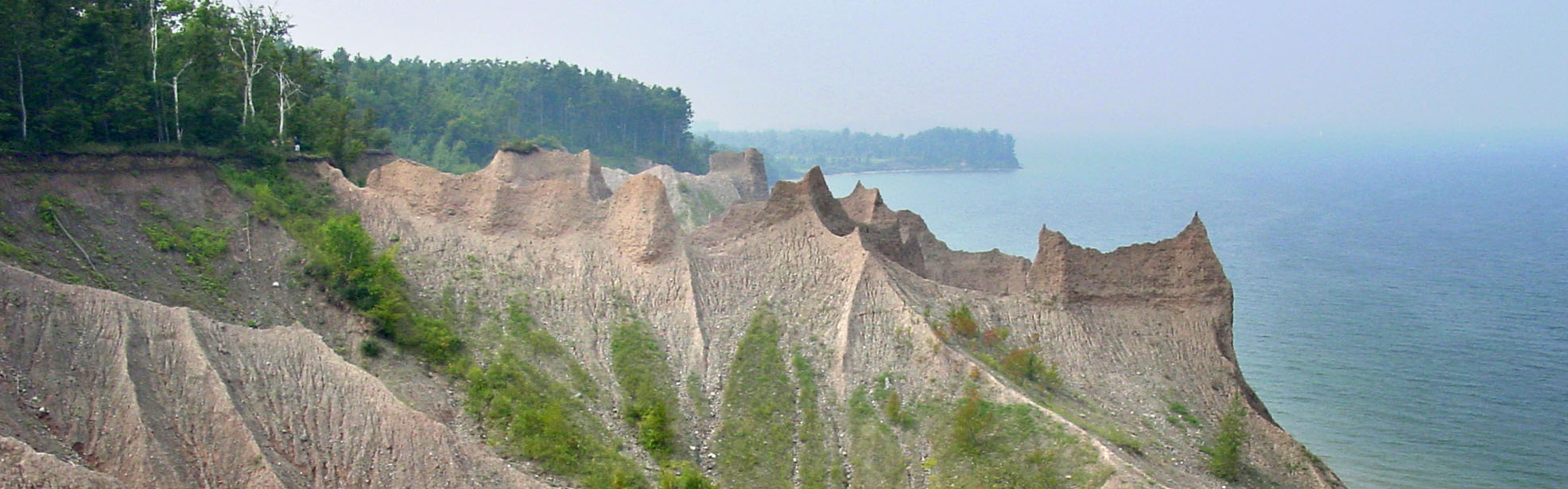
The lake is surrounded by 712 miles of shoreline, with a mix of urban, agricultural, and natural areas. The shoreline is home to diverse habitats, including wetlands, marshes, and rocky cliffs, providing important resources for migratory birds and other wildlife.
Lake Ontario connects to Lake Erie through the Niagara River. The Trent, Oswego and Salmon Rivers are other major tributaries in the Lake.
Lake Ontario is the outlet of the Great Lakes system, draining into the Atlantic Ocean via the Saint Lawrence River. A drop of water entering Lake Ontario from the Niagara River could take around 6 years to flow to the St Lawrence River.
Known as the Lower Lake, all the other Great Lakes drain into Lake Ontario.
- The 35-mile Niagara River links Lake Erie and Lake Ontario, and sends approximately 50,000 to 100,000 cubic feet of water per second over the Niagara Falls. Natural barriers like Niagra Falls prevented movement of fish and boats to the upper Great Lakes.
- Humans build canals, like the Welland Canal, to connect the two lakes for maritime transportation and shipping. These changes inadvertently impacted other Great Lakes as it allowed nonindigenous species, like Atlantic Sea Lamprey, to enter the upper Great Lakes.
Lake Ontario: Fast Figures
- Shoreline length: 712 mi (1,146 km), including islands
- Length: 193 mi (311 km)
- Length is measured as the longest single direction across a lake. For Lake Huron, this path is north-south.
- Breadth: 53 mi (85 km)
- Breadth is the shortest cross-section distance across a lake.
- Elevation: 243.3 ft (74.2 m) above sea level
- Average depth: 283 ft (86 m) measured at low water
- Maximum depth: 802 ft (244 m) measured at low water
- Volume: 393 cubic mi (1,639 cubic km) measured at low water
- Water surface area: 7,340 square mi (19,009 square km)
- Drainage basin area: 24,720 square mi (64,030 square km)
- Outlets: St. Lawrence River to the Atlantic Ocean
- Replacement time: 6 years
- Population in watershed: ~5.6 million people
- U.S. population: ~2.8 million people
- Canada population: ~2.8 million people
Connections to Stewards of the Lake
Indigenous peoples have long been stewards of Lake Ontario (Niigani-gichigami), and they help ensure the lake’s life-giving resources remain abundant and cared for much like family. Traditional ecological knowledge (TEK) encompasses the dynamic relationship between all living things and the environment they share.
This knowledge continues to be passed from one generation to the next. Examples of TEK are the traditional teachings, way of life, and interwoven relationship of fishing, agriculture, land management, cultural values, oral history and connection to land. An example of traditional teaching is that in addition to all the beings in and around the water, the waters themselves are considered relatives.
Today, Lake Ontario is surrounded by agricultural land and forest on the US side, and more urban centers like Toronto and industrial areas on the Canadian side. Recreation and tourism are a major part of the watershed’s economy due to close proximity to Niagara Falls and several state, provincial and national parks. Fishing, both recreational and commercial, are also important elements of the Lake Ontario economy. The lake’s connection to the Atlantic Ocean also drives shipping traffic to 13 major commercial ports.
Great Lakes Sea Grant Network partners, through CGLL, support educators engaging youth in Lake Ontario stewardship with professional learning and resources. By working together, our collective efforts can help protect Lake Ontario.
References
Environmental Protection Agency. (2023). Physical Features of the Great Lakes. | Link
Hecky, R.E., Dobiesz, N., Axler, R.P., Host, G.E., Brown, T.N., Will, N., & Hagley, C. (2014). Global Great Lakes: Integrating yesterday, today and tomorrow and transforming environmental data into anticipatory ecosystem management. University of Minnesota Duluth. | Link
NOAA. (2024). Lake Ontario. National Marine Ecosystem Status. | Link
Schroeder, B., O’Keefe, D., & Dann, S. (2019). The Life of the Lakes: A guide to the Great Lakes fishery. (4th Ed.). University of Michigan Press. | Link
CGLL Partners Serving the Lake Ontario Watershed
If you teach or learn in the Lake Ontario watershed, our CGLL Sea Grant educator team is eager to collaborate with you! The New York Sea Grant program offers leadership, educational programs, and resources tailored to Lake Ontario.


